Portail:Terril 75 (Pinchonvalles)/Info : Différence entre versions
De Du haut d'min terril
| (7 révisions intermédiaires par 2 utilisateurs sont masquées) | |||
| Ligne 1 : | Ligne 1 : | ||
{{Infos terril | {{Infos terril | ||
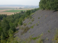
| − | |Image= | + | |Image=T 75 SITE 2003 COHEZ.JPG |
|Coord=50.406767,2.8022 | |Coord=50.406767,2.8022 | ||
|Commune=Avion | |Commune=Avion | ||
| − | |Surface= | + | |Surface=74 |
|Aterril=1907 | |Aterril=1907 | ||
|Arrêt=1960 | |Arrêt=1960 | ||
|Schiste=Rouge et noir | |Schiste=Rouge et noir | ||
|Cubage=37375 | |Cubage=37375 | ||
| − | |Fosse= | + | |Fosse=Activité du lavoir et fosse 6 et 7 |
|Concession=Liévin | |Concession=Liévin | ||
| − | |Proprietaire= | + | |Proprietaire=Logo Pas-de-Calais.jpg |
| − | |Gestionnaire= | + | |Gestionnaire=Logo eden 62.png |
|Statuts=ZNIEFF, APPB | |Statuts=ZNIEFF, APPB | ||
|Hauteur=80m | |Hauteur=80m | ||
}} | }} | ||


