Portail:Terril 116-117 (10 de Oignies)/Info : Différence entre versions
De Du haut d'min terril
(Page créée avec « {{Infos terril}} ») |
|||
| Ligne 1 : | Ligne 1 : | ||
| − | {{Infos terril}} | + | {{Infos terril |
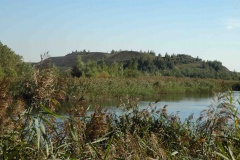
| + | |Image=T 116-117 COHEZ 2007.JPG | ||
| + | |Coord=50.451985,2.99067 | ||
| + | |Commune=Dourges | ||
| + | |Surface=88,13 | ||
| + | |Aterril=1961 | ||
| + | |Schiste=Noir | ||
| + | |Cubage=15111 | ||
| + | |Fosse=Activité du puits n°10 | ||
| + | |Concession=Dourges | ||
| + | |Proprietaire=Logo Pas-de-Calais.jpg | ||
| + | |Gestionnaire=Logo eden 62.png | ||
| + | |Statuts=Espace Naturel Sensible | ||
| + | }} | ||


